
Mapping Location and GeoCode Fields
The new map and routing features in DayBack are currently in preview.
If you'd like these features enabled for preview in your DayBack, please get in touch. (Maps, routing, and drive times require DayBack's Plus plan.)
Field Mapping for Maps and Distances
DayBack’s map, route, and distance features rely on two key fields in your field mapping:
- Location: Stores the street address of your event.
- GeoCode: Stores the latitude and longitude coordinates of your event.
When using DayBack’s geocoding custom action, the address in the Location field is automatically converted into latitude and longitude coordinates and stored in the GeoCode field. This conversion can be automatic or manual, depending on how you configure your DayBack's geocoding custom action.
If your data source already includes geocoded locations or you prefer to handle geocoding yourself, you only need to configure your field mapping in DayBack—there’s no need to install our geocoding action. For more details, please refer to our article on geocoding.
Salesforce Specific
If you're using Salesforce, you may already have your locations geocoded and stored in geolocation fields in some of your standard objects. Geolocation fields are available for standard addresses on accounts, contacts, and leads. Additionally, you can add geolocation fields as custom fields to both standard and custom objects.
While geolocation fields aren't visible directly on Salesforce records, DayBack can access them via the Salesforce API. Any geolocation fields that you have created will appear as an available Geocode field in DayBack’s field mapping dropdowns.
Configuring Geolocation Fields
When adding a geolocation fields to your objects, make sure to select the Degrees, Minutes, Seconds format instead of the decimal format, and set the number of decimal places to zero.

Under the hood, geolocation fields are compound fields and are stored as three discreet fields: a read-only geolocation field and two editable subfields—latitude and longitude. When you add a geolocation custom field, Salesforce automatically creates these three related fields for you. DayBack will recognize and automatically know how to interact with these fields correctly.
Your GeoCode field can also be configured as a text field
If you prefer not to use Salesforce’s geolocation fields for storing your geocoded locations, you can store them in a standard text field instead. However, this method has limitations. With a text field, you won’t be able to use the "Limit to map only" setting to restrict events to a map boundary because the system cannot query latitude and longitude from plain text. In a geolocation field, latitude and longitude are stored as separate subfields, allowing DayBack to calculate map boundaries.
To use text fields instead of geolocation fields:
Click the "Use Text Field " toggle to change the list of drop down options to select from your object's available text fields instead of geolocation fields, as depicted below:

Expected geocode data format:
DayBack will expect that your text field will store geocode data as latitude and longitude values delimited by a comma (i.e. "-44.38109,160.52732 ")
FileMaker Specific
If you're using FileMaker, you already added a location field when you integrated DayBack. You'll also need to add a geocode field to any tables you want to show on the map.
- Create a geocode field as a text field.
- Then, in the FileMaker script “Create Edit Delete Event - DayBack ” duplicate the “
LOCATION” section and modify it to edit the new geocode field.
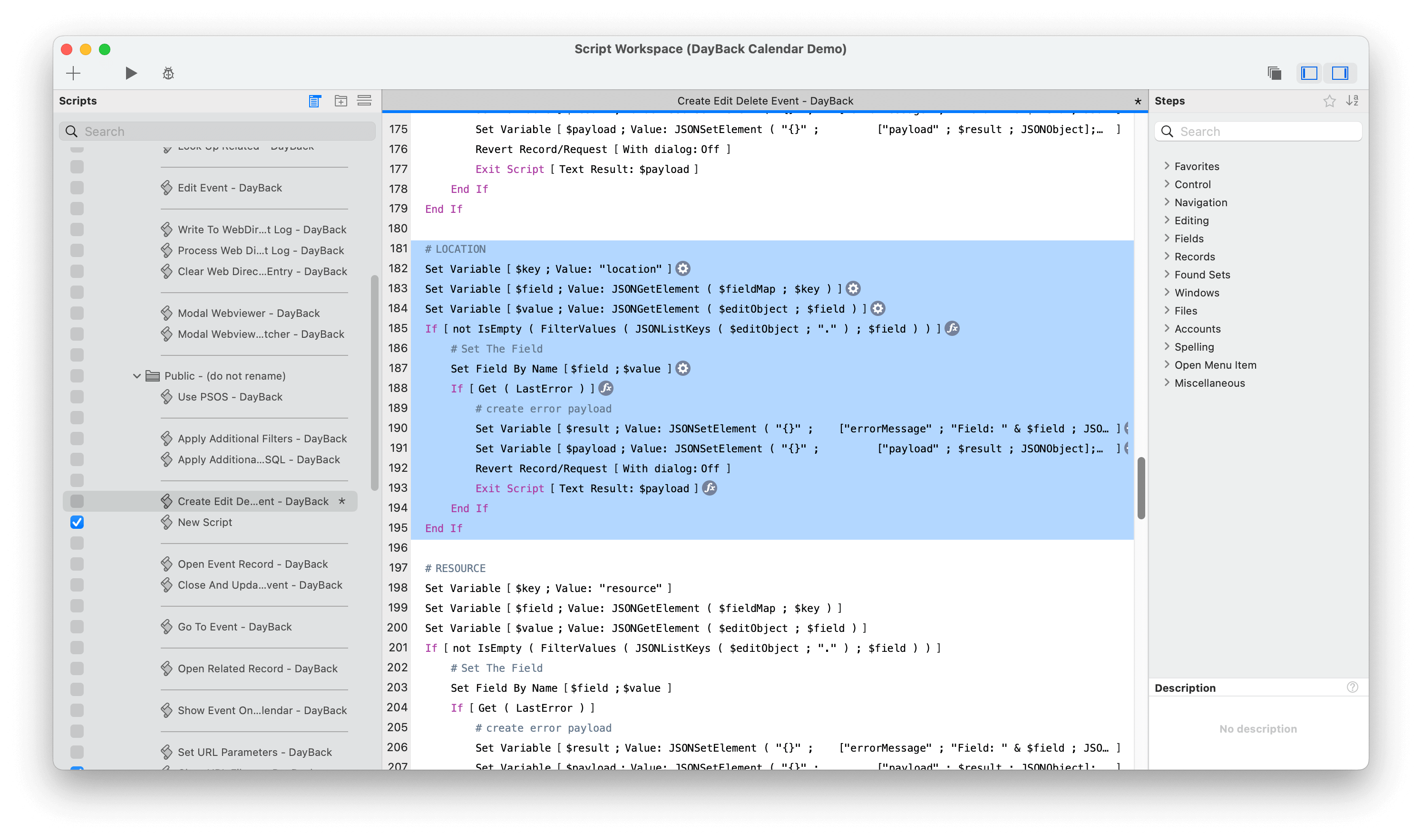
- If you choose to store your geocode data as only a text field, you won’t be able to take advantage of the "Limit to map only" setting when creating new map-only calendar sources. To learn more about, this feature, and how to set this up in FileMaker, please refer to our article on map-only sources for more information.